
District Pithoragarh Location Munsiyari is at 7,000 ft in the Johar Valley carved by the Goriganga River, in far north-east Uttarakhand, and is the confluence of a network of former trade routes that crossed the high passes and glaciers between India and Tibet Distances 109 km NW of Lohaghat, 232 km NE of Almora, 599 NE of Delhi Journey time By road 5 hrs from Chaukori, 6 hrs from Vijaypur, 7 hours from Lohaghat, 10 hrs from Almora, 13, hrs from Kathgodam, 20 hrs from Delhi.
Route from Delhi NH24 to Rampur via Hapur Bypass, Gajraula and Moradabad Bypass;NH87 to Almora via Bilaspur, Rudrapur, Haldwani, Kathgodam, Ranibagh, Bhowali, Khairna and Sualbari; state highway to Bageshwar via Takula; state road to Chaukori via Vijaypur; state road to Munsiyari via Thal and Ratapani
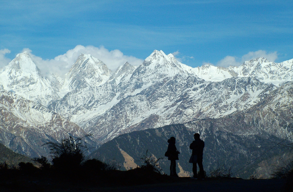
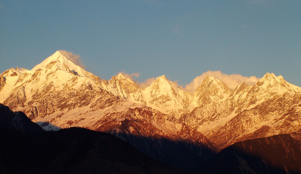
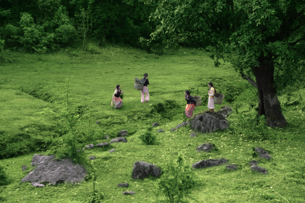
Munsiyari sits comfortably somewhere in the middle aisle of a grand amphitheatre. In front, like a 70 mm projection, is the Panchachuli range, Hansling, Rajarambha and Chiplakot, all peaks over 19,000 ft. At sunset, when the sky sets ablaze, one anticipates the striking up of magnificent orchestra, inundating the valley with Dolby surround sound. Then all of a sudden, as if someone has thrown a switch, the colour drains out in front, leaving the sky and mountains in soft tones of pink and grey, like the colours of a dove in a Mughal miniature. At night it is perfectly still and quiet. A few pinpricks of light mark the houses of the town and distant villages in the far hills. That is all. There are no idli-dosa joints, no pony rides, and no bus loads of noisy tourists from the plains. Thank god. Myth and history get blurred when they intersect with the geography of the Johar Valley, of which Munsiyari is the largest town.
The Panchachuli Range dominates the vista. They say that it was the last resting place of the Pandavas, a site where they cooked their last meal before ascending to heaven. They say,too, that the inhabitants of the valley were once Nagas, great serpents, who were persecuted by a Garuda who wiped out all but the last inhabitant. Before he could do that, he was struck down by the emissary of Shaukya Lama, a wise guru of the north. The emissary was so taken in by the beauty of the place that he decided to stay, and so originated the Shaukya tribe, who still inhabit the Johar Valley. They were Because of the altitude, agriculture was limited, so they took to trading with Tibet and grew prosperous. Milam, a village 54 km up the Goriganga from Munsiyari, boasted of 500 families and Munsiyari itself became a bustling entrepot. Sadly, all that changed with the Indo-China War in 1962 and trade was stopped. The area, with its tiny population, also produced its share of heroes: three IAS officers since Independence. Before that, between 1865-66 a son of Milam, Pundit Nain Singh, employee of the Survey of India, went clandestinely on foot into an enterprising lot Tibet and mapped the hitherto unknown territories between Ladakh and Lhasa and the Kailash-Manasarovar region. For his effort he became the first Indian to win the coveted gold medal from the Royal Geographical Society in London.
The drive to Munsiyari
The map lied: its clean, relatively straight line
running from Almora north-east to
Munsiyari made the 232 km seem easily traversable in a
day. It didn’t account for
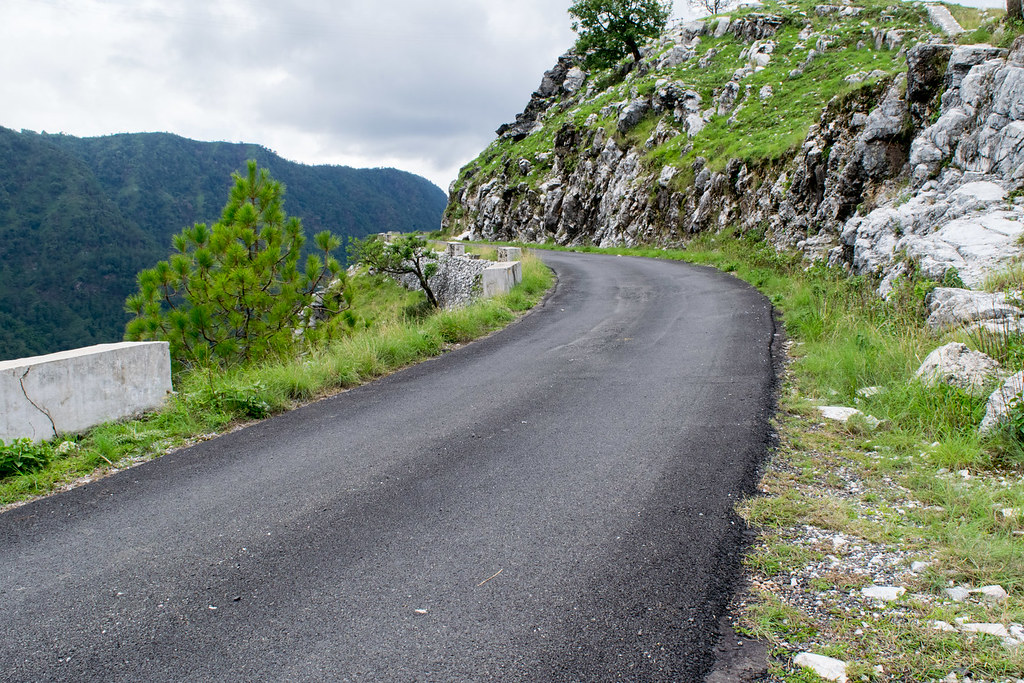
the tightly winding roads which led the struggling
vehicle up to 9,000-foot windswept passes; nor hinted at the innumerable breaks
one needed to dally at waterfalls, swim in rivers, picnic in deodar
forests, or pick rhododendron flowers. For Munsiyari, perched as it is at
the edge of the horizon, the journey there is as wonderful as the
destination. To get the most out of it, the trip should be treated
as a leisurely driving holiday with at least a week in hand. Tovernighted at Almora and then drove to Vijaypur via
the ancient temple town of Bageshwar.The road then climbs
steadily through chir forested slopes, picturesque villages and entire
hillsides sculpted into lush, terraced fields. One can camp overnight at
Vijaypur or carry on further to Chaukori. One can also spend a day
relaxing in either of the two places as they afford excellent views of
Nanda Devi and the surrounding peaks in autumn and early spring
before summer sets in.
By the time we crossed Thal (26 km from Chaukori) and
entered the beautiful Ramganga east gorge it was lunchtime fortuitously.
About 10 km from Thal and
2 km before the village of Nachani, a small dirt track
leads off the main road down to the river. Spend at least an hour
on a picnic lunch and swim in the icecold, turquoise waters of the Ramganga.About
34 km before Munsiyari, right after you cross the Bala bridge, take a tea
break at the Birthi Falls. Plummeting
own 125m, this is the tallest waterfall of the area. Travel to
this area between March and April and, climbing up from Birthi,
marvel at the rhododendron trees with blood-red flowers at Ratapani.Then
ascend towards the 9,000-foot pass at Kalamuni, and watch the blooms turn
from fuschia to rose-pink, to white with the faintest blush of pink.
Kalamuni is the vantage point on the top of a great amphitheatre
whose backdrop is the snow-amassed Panchachuli Range & also has a
small but powerful Kali Temple. The next stop – Munsiyari – is just
23 km away.
THINGS TO SEE AND DO
There are a number of sights in the immediate vicinity
of Munsiyari, most of which should be visited on foot. For the
sights further away, drive, or take a taxi (Rs 1,200 per day), if you
haven’t driven up yourself.
Maheshwari or Mehsar
Kund
Once upon a time, a Yaksha who lived in a small lake
above Munsiyari, fell in love and eloped with daughter. The
villagers, angry and eager to avenge the dishonour, drained the lake
dry. Furious, the Yaksha cursed the village and the villagers found themselves
facing successive years of drought and famine until they apologised and
made obeisance to the spirit, a practice which
continues even today. Walk uphill a couple of hundred yards from the
Munsiyari Forest Rest House and you will find a paved path moving uphill
on your right. Follow the path as it climbs steadily for half an
hour through a pretty forest, until you arrive at a small meadow
ringed by huge oaks and rhododendrons. On the northern edge of
the meadow lies the lake. Today it’s a mere pond, but a charming spot,
nonetheless, for a picnic accompanied the sarpanch’s by great
views of the Panchachuli Range.
Dar Kot
About 6 km from Munsiyari on the MadKot Road lies the
small village of DarKot. Spend an afternoon amidst the 100-year-old
wooden houses with traditionally carved doors and windows. And if you
have money to spare, then there is no better place to shop for pure
handmade pashmina and angora shawls and sheepswool
blankets. A good pashmina should set you back anywhere between Rs
3,500-6,500, depending on the size, and a chutka, a thick
sheepswool blanket, by Rs 3,000.
Goriganga River Bed
Drive 17 km from Munsiyari down the Mad Kot Road to
Bhadeli, marked by a solitary tea shop near some fields. Walk a Himalanga
bit upriver and find a spot for a picnic
lunch and dip in the icy waters of the Goriganga River.
Masterji’s Museum
Dr SS Pangthi, or Masterji, a retired school-teacher,
trekker, traveller, author and authority on the Bhotias of the area,
has enterprisingly put together a small. collection of antiques in a
private museum at his residence in Nanasen Village.Of great interest are
the original docu-
ments, which enabled trade between the Johar Valley
and Tibet and the personal effects of the traders. The museum is 2 km
from the Wayfarer Retreat.
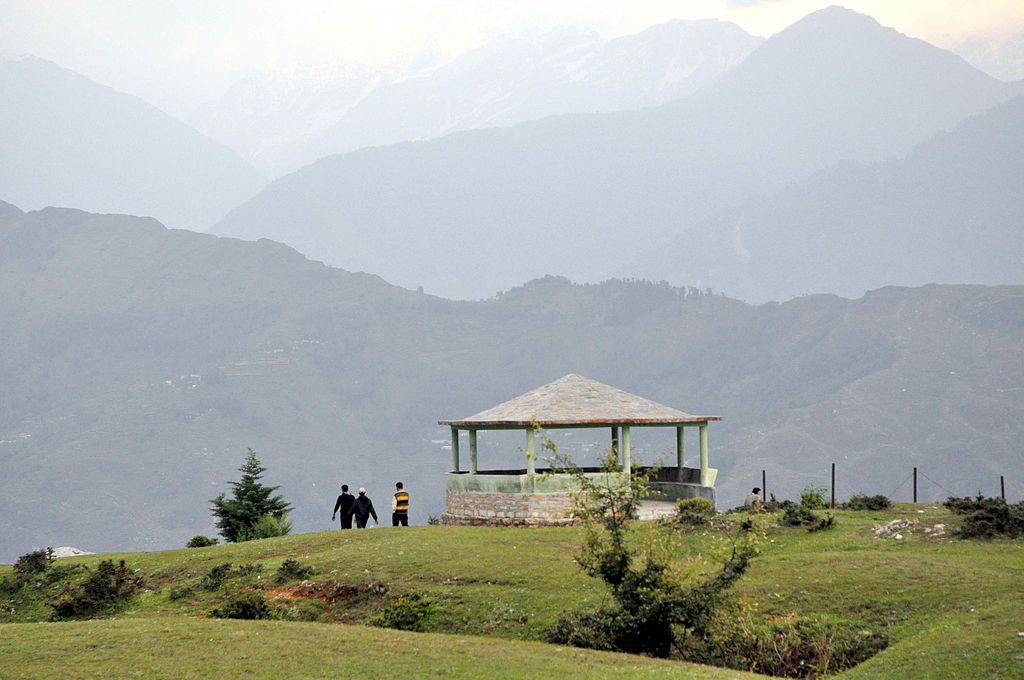
Picnic on the Munsiyari Bugyal
Hike up to this lovely meadow just east of the town off the Zara Resort Road. It’s a
very easy walk and a must for magnificent views
of the Panchachuli Range, the
Johar Valley with its route to the Milam
Glacier, and the village of Harkot, dropping
far below in the valley to your
right, nestling among terraced green fields. Walk straight due east as the bugyal dips down towards the Nanda Devi Mandir. Return to town via the old Gas Godown Road.The bugyal is 6 km from the
Wayfarer Retreat, a 3-hr walk
one-way. The best way to do it is
to head out post-breakfast, climb
up, spend a couple of hours up there
taking in the views over a packed
picnic lunch, then walk the 3-km back, returning by evening.
Balanti
About 8 km from Munsiyari heading back up towards Kalamuni, some 400m off the main road, is the Balanti Potato Farm, conjuring up an image of a rather dull place for an outing, belying the breathtaking 180°
views of the snowpeaks just part of the day’s attraction. The other
part is the ancient oak and rhododendron
forest, with its old, moss-covered rocks
and great, benign trees. The place has the
air of magic: don’t be surprised to come
upon druids and elves and fairies.
ON THE RETURN DRIVE
The Bala cascades Start
early for the return trip armed with a packed lunch and swimsuit, and stop at Bala just past the Birthi Falls. Park the car
by the tea shop and head back across the
bridge. Find a path moving upriver and
jump down across the rocks to find
beautiful, clear blue natural swimming
pools on at least three different levels. I
could have spent the whole day jumping
off rocks into the icy waters of the Bala
River. If the urge should overtake you,You could always spend the night at the KMVN rest
house up the road at Birthi.

Long time supporter, and thought I’d drop a comment.
Your wordpress site is very sleek – hope you don’t mind me asking what theme you’re using?
(and don’t mind if I steal it? :P)
I just launched my site –also built in wordpress like yours– but the theme slows (!) the site down quite a bit.
In case you have a minute, you can find it by searching
for “royal cbd” on Google (would appreciate any feedback) – it’s still in the works.
Keep up the good work– and hope you all take care of yourself during the coronavirus scare!